(prepared by Paul Leistner, 01/14/2026)
For many years, the City of Portland Bureau of Planning and Sustainability has offered to produce one free color map (paper and PDF) for each neighborhood association each year. (Most NAs do not know about this.)
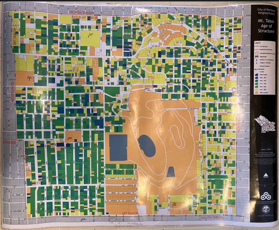
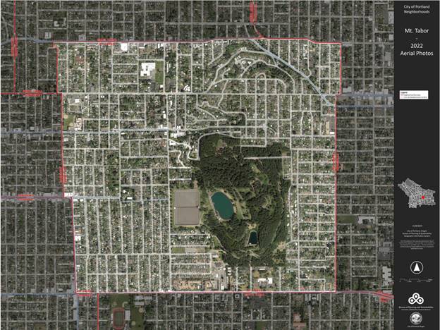
These maps are great! The Mt. Tabor Neighborhood Association (MTNA) has three map versions that we’ve laminated and us at meetings and for tabling at events. Community members are really drawn to the maps. They like to find where they live and enjoy seeing a big picture version of the neighborhood. (I’ve pasted in below a couple photos of our maps.)
BPS has access to the City’s GIS system and can create maps with different layers of information. They also have a large format color printer. The paper maps they produced for us range in size from 34-36 inches x 43.5-47 inches.
We had our paper maps laminated to protect them and make it much easier to transport them safely to events and store them
The MTNA has three map versions:
- one basic map of the streets and tax lots and other major features (schools, parks, etc.) in the neighborhood
- an aerial view map of the neighborhood (“Aerial Photos Map”)
- a map that shows when different lots were developed over time (i.e. by time period, e.g. “1889 & earlier” “1890 – 1904” “1905-1916″….. etc.) (“Age of Structures Map”)
Kinds of info layers you might request:
- Neighborhood Boundaries and NA names (color within boundary and B&W outside)
- Water Bodies
- Schools (K12 and Alternative)
- College or University
- Building Footprints
- Tax Lots
- Streets and Street names
- Parks
- etc.
Who to contact at BPS to get a map produced?
You can request a map by emailing the BPS GIS team at:
It’s always good to talk with them about the kind of map you want and the types of info layers they could include before they produce the map.
Where to laminate a large map?
I’ve found that one of the best places that has the equipment to laminate a large paper map is Precision Images on lower SE Hawthorne Bd. (https://www.precisionimages.com/)
I recommend you ask for the 3 mil lamination thickness–it’s easier to roll up than the 5 mil. (The cost is the same for either one.) The final laminated map extends about 3/16 inches beyond the paper map all the way around so the edges are all sealed.
Precision Images in the past charged $2/square foot to laminate a map. The MTNA maps cost $24 to laminate.
EXAMPLES
Mt. Tabor Neighborhood—Aerial View
Mt. Tabor Neighborhood—Age of Structures